A booming market
The ability to adapt, anticipate change, and stay at the forefront of technology trends has shaped many of the most successful companies on their journey to the top. One such technology trend that emerged in 2018 is the adoption of drones. Drones are more than just flying cameras, they are completely transforming the entire market and technology researchers are just scratching the surface of what they can do for society. Consumer drones are becoming increasingly popular among people that want to earn a second income, explore with aerial photography, or fly drones for fun, in addition to outdoor explorers and adventurers. The emergence of self-flying drones and the general increase in the use of drones has spawned a new emerging market, drone analytics. The global consumer drone market size was valued at USD 3.42 billion in 2021 and is anticipated to grow at a compound annual growth rate (CAGR) of 13.8% from 2022 to 2030 (GrandViewResearch survey, 2021).
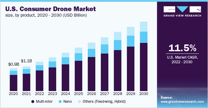
(Source: GrandViewResearch, 2022)
What is drone analytics?
A drone’s primary purpose is to hover over an area that has to be inspected and gather the necessary information. A drone analytics software is required to allow the drone hardware to gather the data. Thus, drone analytics include monitoring the drone’s flight, producing 2D and 3D representations of the area or site being surveyed, and processing the visualisations so that the user may examine and modify them as needed. In general, the processed data is referred to as geospatial data. Drones that are equipped with IoT technology can go to survey the locations that are otherwise not possible for humans to reach without a lot of effort. This ability of drones can be used to inspect and generate data for locations or hotspots and will eliminate human intervention for the task. The data that is gathered using these drones helps to analyse and predict various attributes of a subject in a multitude of fields and industries. Some of the major fields where drone analytics has proven to be crucial are:
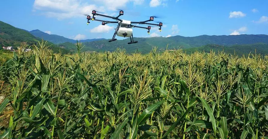
Drones in agriculture
Drones are mostly used for crop surveillance. It involves monitoring the growth of a crop from the time the seeds are sown until harvest. The Normalised Difference Vegetation Index is a specialised imaging system that the drones are outfitted with (NDVI). The NDVI provides precise colour information to show the state of the plant.
- Drone analytics helps to generate crucial agri-data like soil erosion between crops, inspection of water conditions in the fields, identifying weeds or other invasive species and monitoring plant stress.
- The data gathered that is in either visual format or via sensors from the drone is feeded to the algorithms that constantly learn via Machine Learning and predict the situation that the farm or field is in.
- Agrimo is one of the companies that uses AI to perform analytics through aerial imagery of the farms to generate insights like crop count in the field, soil health and detection of invaders. Read more about the role of drones in agriculture.
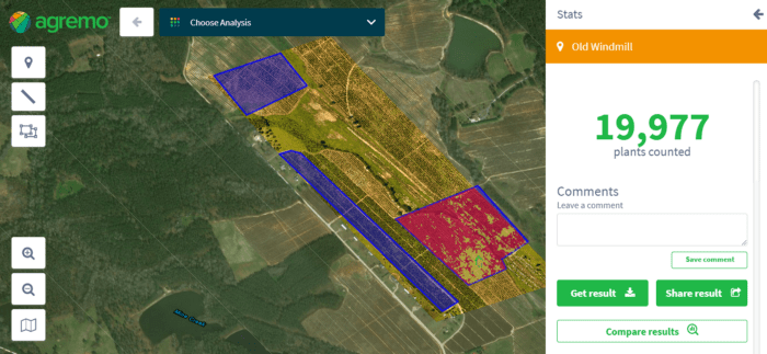
(Source: Agremo.com, 2022)
Drones can aid in disaster management
Visual imaging and 3D mapping have a significant positive impact on areas that are vulnerable to large-scale disasters like earthquakes and flooding. Drones that survey a disaster site can generate critical insights as follows:
- Through aerial imagery and 3-D mapping, drone analytics uses colour coded image overlays on the recorded topography to highlight the regions that are affected by the disaster or are in the danger zone.
(Source: equinoxsdrones.com 2022)
- Drone analytics is a critical methodology used for post disaster assessment of catastrophe. Following a terrible earthquake in Nepal in 2015, disaster management professionals employed drones to produce intricate 3D maps. The maps were subsequently utilised to restore damaged regions of the city and assisted officials in identifying the most susceptible places.
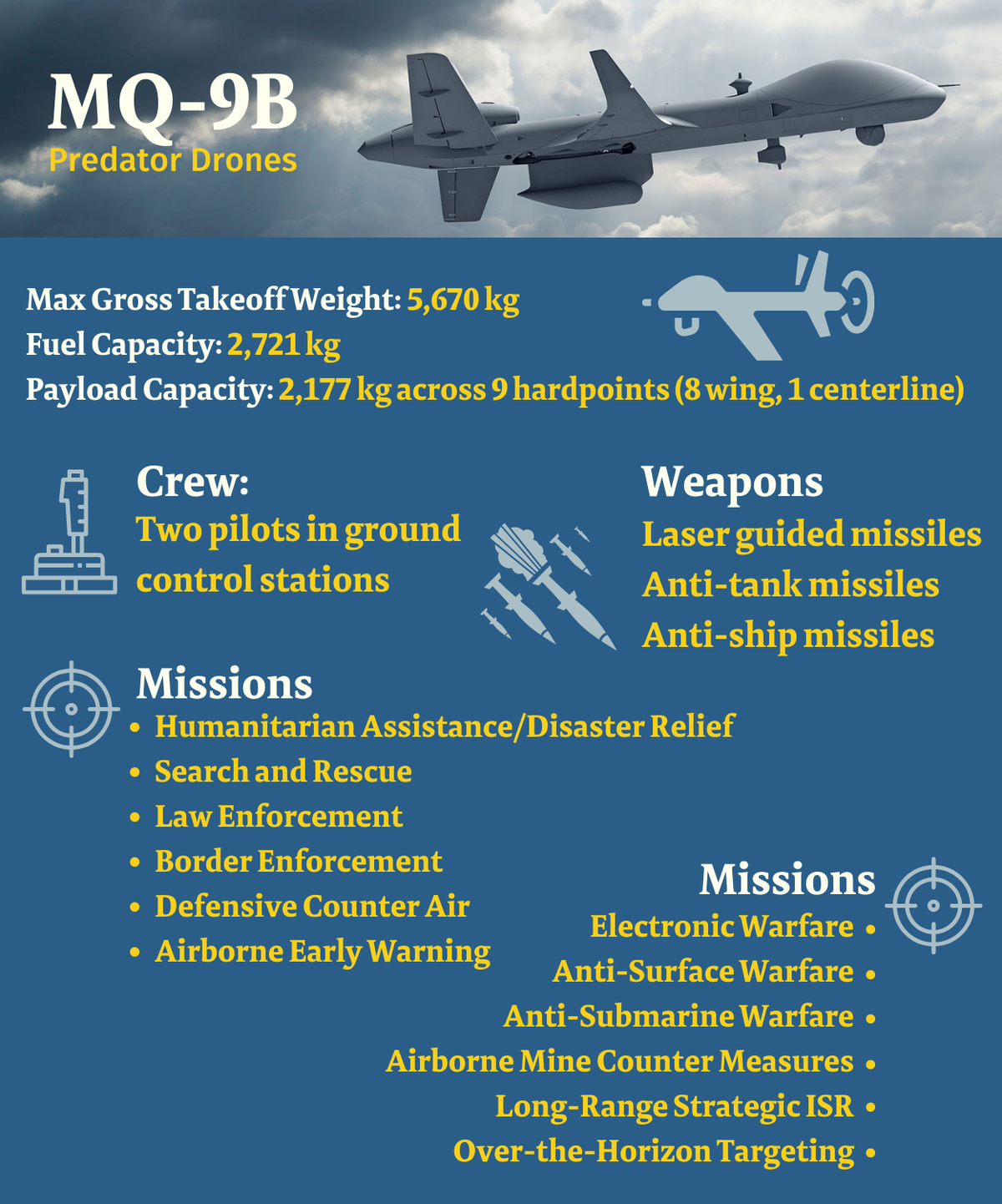
Drones in the military
The very first real world application of drones was in the military. Remotely piloted vehicles (RPVs), also referred to as drones, were the first UAVs. Small radio-controlled aircraft known as drones were first employed during World War II as targets for fighters and anti-aircraft weapons.
- The primary uses of drone analytics software in the defence & security sector, which is its largest customer, include border patrol, tracking illicit activity, identifying attack-prone locations, continuous surveillance, and crowd and traffic monitoring.
- The Indian army has also implemented drone analytics through drone feed analysis systems. The Drone Feed Analysis system is an AI deep learning tool that examines items recovered by remotely piloted aircraft, creates a database repository, and performs AI-enabled analysis to provide military patterns of adversary actions as well as analysis and event prediction in case of a terror attack.
- The Russia-Ukraine war has brought in light the first ever full fledged drone war. Ukraine recruited hundreds of drone operators who fly drones over Russian territory and bring back aerial imagery of the enemy areas. This data is then analysed using AI and machine learning algorithms to identify square objects and further analysing any geographical discrepancies like inconsistent grass or texture to locate Russian camouflaged vehicles. Read more about how drones are crucial in the Ukraine war.
(Source: TheHindu, 2022)
Drone analytics will be of great use for the military as the data gathered and analysed by the drones in warfare locations can help the drones to pin-point the exact location of the enemy base and help in developing warfare strategies.
Current developments and future prospects
The drone market is growing rapidly with researches identifying numerous industries where drone analytics can be of high importance. One such industry is the solar industry where a U.S., India startup called SenseHawk is aiming to provide insights through drone analytics for the solar industry. It is currently operational in three markets: its two home countries and Australia. SenseHawk is creating an AI platform with several modules, such as heat analysis, construction monitoring and analytics, and terrain-based analytical tools. In 2022, Reliance Industries even announced their acquisition of 79.4% stake in the company which further expands its prospect in the Indian solar market.
With the developments in IoT and its integration in drone technology, drones will further aid in agriculture through more complex activities like livestock management and health monitoring through sensors and cameras. Similarly drone analytics will have an inexpensible role in various search and rescue operations where drones enabled with LIDAR technique will be able to locate people during a rescue operation and search in water bodies which is often the most difficult. 5G will further evolve the drone technology as it would support higher cloud computing capability and better IoT integration.
With all these prospects that are just a handful from the vast possibilities around the world, drones certainly have become an indispensable part of the technology world and its evolution with other technologies is sure to bring about a revolution around the world.
The global Drone Analytics market size was valued at USD 2252.27 million in 2021 and is expected to expand at a CAGR of 31.23Percent during the forecast period, reaching USD 11502.92 million by 2027, So yes drones are the future.