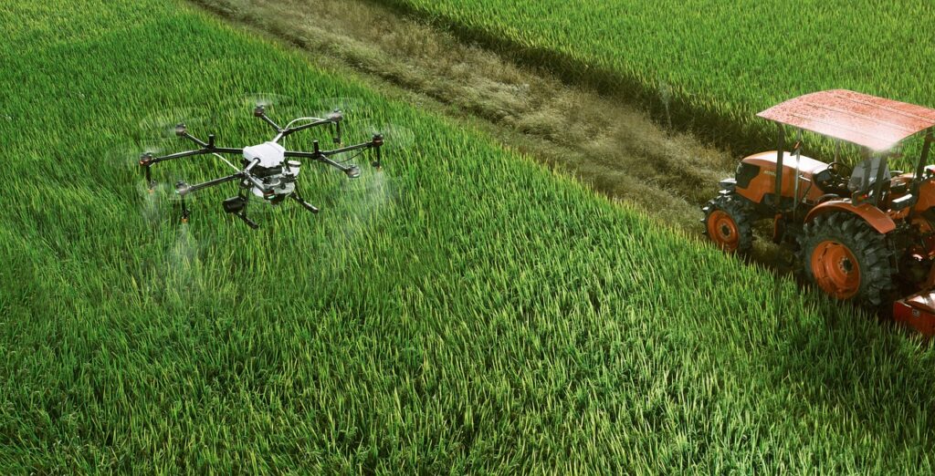
The agriculture industry is the most promising one, but it faces several challenges today, one of which is the scarcity of labour for farming. Extreme weather conditions, an inadequate supply and ineffective application of fertiliser, infections, illnesses, allergies, and other health issues brought on by chemical application (fungicides, pesticides, insecticides, etc.) or insect or animal bites are additional issues or concerns. The use of unmanned aerial vehicles (UAVs) or drones in agriculture can considerably improve risk and damage assessments, transform how we prepare for catastrophes that threaten the livelihoods of vulnerable farmers and fishermen, and improve the nation’s food security.
Drones in controlling rodent damages
Farmers require a reliable way to assess the location and quantity of rats in a field, which poses a significant difficulty in reducing rodent populations. Farmers often become aware of the existence of rodents when there are already many of them, there are plenty of burrows, and the damage is so severe that bare patches of the field are apparent to the naked eye. Farmers may be able to apply control more vigorously in some regions before the vole population gets out of hand if they can locate rodents while there are few of them. Sadly, mice not only reduce agricultural output; the rodenticides used to combat them are also costly (due to both purchase and distribution expenses) and hazardous to the environment.

A study conducted in nine Alfalfa fields located in the Hula Valley, Israel to control rodent damage in the fields showed how drone and analytics can be used to effectively combat rodent riots without damaging the crops. Spectral vegetation indices were created using drone footage and offered precise, high-spatial-resolution estimations of the quantity (biomass) and health (NDVI) of alfalfa. It was found that UAV photos may be a highly useful tool for locating rodent hotspots and evaluating rodent damage by employing burrow counts and rodent trapping. The fields can be regularly surveyed by the drones and high resolution images from the drones helps to identify the vole burrows. This is effective as manual labour while identifying and setting up traps damages the crops as much as the rodents do.
Identifying invasive species of fauna
Various invasive species of fauna that are similar to weeds tend to steal the nutrition of the crops and spread like wildfire in the area. This is harmful for any farmer and their field as it results in decreased production of crops and in turn decreased grazing area for the cattle. One of the species called Pedicularis tends to spread in a wide area, and the following is a case study that better showcases how drones are an effective way to counter this problem.

Most people recognise Pedicularis plants as lousewort (Pediculas is the Latin word meaning louse). The fruit season is from July to September, while the blooming season is from June to August. The second-largest grassland in China, Bayinbuluke, was discovered to have a significant Pedicularis epidemic that had been infesting a 4.11×10⁴ hm2 area. This phenomena has changed the local grasslands’ population makeup and feed availability, which has had an impact on the evolution of grassland animal husbandry. Thus a study was conducted where drones equipped with various sensors were deployed in the area to analyse the pattern of growth and the prediction of the growth rate and area spread of the louse plant. The aerial imagery was then feeded to the positive and unlabeled learning (PUL) algorithms for analysis and insights on finding any patterns that resulted in this widespread invasion of the crop field areas. Overall Pedicularis extraction accuracy with the PUL was 97.89% (F-score: 0.9697). Pedicularis may be distinguished from other species using multispectral photography, with the green band serving as the primary indicator.
With a much higher accuracy, the Pedicularis plant could be identified with a much easier approach than that of manual labour. This is a rich method that can be used by farmers of larger farms or grasslands as it is much easier and less time taking to identify fauna invaders
Drones in predicting yield of the crops
China is one of the largest producers of rice in the world, being a mass producer, the farmers have to be very careful in selecting the methods that allow them to get the best yield. The use of drones for this purpose has increased rapidly as aerial imaging in addition to various analytic algorithms can help predict the kind of and quality of the yield that the farm will have. The case given below explains how some farms in China adapted drones to predict the crop yield:

Four experiments were conducted in the Rugao and Xinghua districts of Jiangsu province, China from 2015–2018 where 8-rotor UAVs were deployed in the fields as they would capture images and survey the crops for the farmers. For the length of the trip, images were acquired every three seconds at a height of 100 metres, giving each one a ground spatial resolution of 5.4 cm per pixel. Throughout the three growth seasons, the UAV was flown over the paddy field at the booting and filling stages. Due to the limited research area, only one image from each trip (encompassing all the plots) was chosen for further analysis. With UAV-based multispectral pictures, this study forecast rice grain yield and evaluated the model’s applicability to various rice cultivars, sensor types, and growing seasons. The yield prediction models were separately developed and verified using the dataset from various years, cultivars, and sensors. Spectral and texture data were retrieved from UAV photos. GNDTI was discovered to be the most accurate indicator for predicting rice yield across various years, rice cultivars, and sensors. The prediction models of 2016 outperformed 2015 in terms of forecast accuracy across all years.
With the ever evolving technologies that we are seeing day in and day out and the integration of these technologies with each other is giving birth to some of the possibilities that were not even thought of in the past decade. Drones are revolutionising almost every sector globally and technologies like AI and ML are only pushing it further up the ladder. The coming decade will be a very crucial one as it will be the defining moment of how drones will become an integral part of the world in the coming future.